
Optional camera calibration and native pixel-to-ground geometry only. More...
#include <stdbool.h>#include <stddef.h>#include <stdint.h>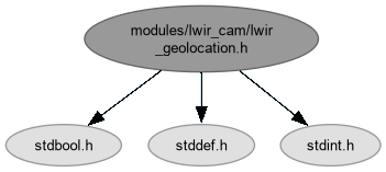
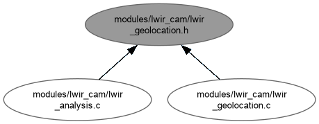
Go to the source code of this file.
Data Structures | |
| struct | lwir_camera_geometry |
| Projection calibration in native coordinates, never display coordinates. More... | |
| struct | lwir_camera_pose |
| Observation pose; geographic angles are degrees, attitude angles radians. More... | |
| struct | lwir_ground_point |
| WGS84 estimate on a local horizontal plane, not a surveyed accuracy claim. More... | |
Functions | |
| bool | lwir_geolocation_load_calibration (const char *path, unsigned width, unsigned height, struct lwir_camera_geometry *geometry) |
| Load bounded projection calibration, requiring exact native dimensions. | |
| bool | lwir_geolocation_project (double pixel_x, double pixel_y, const struct lwir_camera_geometry *geometry, const struct lwir_camera_pose *pose, struct lwir_ground_point *point) |
| Project a native subpixel location using distortion, mount and observation pose. | |
Detailed Description
Optional camera calibration and native pixel-to-ground geometry only.
Compiled only in analysis builds (LWIR_ENABLE_ANALYSIS=1). Used by lwir_analysis.c to turn hotspot centroids found in the native temperature plane of a saved LWIR JPEG into estimated WGS84 positions. No detection, JPEG or EXIF code lives here, so the geometry can be tested with synthetic poses.
Frames (all right-handed):
- camera: x right, y down, z forward along the optical axis (OpenCV);
- body: x forward, y right, z down;
- local NED at the navigation reference: north, east, down.
Model limits callers must respect:
- pinhole plus Brown-Conrady distortion; strong fisheye lenses are outside it;
- the ground is a horizontal plane agl_m below the navigation reference, so terrain relief and slope translate directly into horizontal error;
- pose quality is the caller's responsibility: a pose stamped at frame arrival rather than over the exposure interval can be displaced by aircraft motion, so projection results must be qualified with the pose timing evidence;
- an unverified calibration yields plausible-looking but unqualified numbers.
Definition in file lwir_geolocation.h.
Function Documentation
◆ lwir_geolocation_load_calibration()
| bool lwir_geolocation_load_calibration | ( | const char * | path, |
| unsigned | width, | ||
| unsigned | height, | ||
| struct lwir_camera_geometry * | geometry ) |
Load bounded projection calibration, requiring exact native dimensions.
- Parameters
-
[in] path Nonempty regular calibration file, at most 8192 bytes. width Expected native image width, within the supported LWIR bounds. height Expected native image height, within the supported LWIR bounds. [out] geometry Result, unchanged on failure.
- Returns
- True for structurally valid calibration, not proof of physical accuracy.
This is a bounded profile reader, not a general YAML implementation. Each scalar or bracketed numeric array must fit on one line. Required fields include all lens coefficients, dimensions, verification flag and the nine-value rotation; duplicate known fields fail. Optional lever arm defaults to zero and minimum_ground_cosine to 0.2. Unknown keys are ignored.
- Note
- An unverified profile is intentionally loadable for workshop checks. Loading does not validate rotation orthonormality; projection checks it before use. Neither operation establishes that a mount was physically measured.
- Lines longer than 511 characters, a missing ':' on a non-comment line, verified other than 0/1, nonpositive focal lengths, or a minimum_ground_cosine outside 0.05..1 all fail. Lines starting with '#', '' or consisting of --- are skipped. errno is not part of the failure contract.
Load bounded projection calibration, requiring exact native dimensions.
Reads key: value lines (a YAML-like subset) into a local copy and publishes it only after all checks pass, so geometry is never half-written. A bitmask of seen keys detects duplicates and missing required keys.
- Returns
- True for a structurally valid profile; false for I/O errors, a non-regular/empty/oversized file, syntax errors, duplicates, missing keys or out-of-range values.
Definition at line 137 of file lwir_geolocation.c.
◆ lwir_geolocation_project()
| bool lwir_geolocation_project | ( | double | pixel_x, |
| double | pixel_y, | ||
| const struct lwir_camera_geometry * | camera, | ||
| const struct lwir_camera_pose * | pose, | ||
| struct lwir_ground_point * | point ) |
Project a native subpixel location using distortion, mount and observation pose.
- Parameters
-
pixel_x Native column, independent of JPEG rotation. pixel_y Native row. [in] camera Intrinsics and proper camera-to-body rotation. [in] pose Observation position, attitude and positive height above the ground plane. [out] point Result, unchanged on failure.
- Returns
- False for invalid/nonfinite geometry, nonconvergence or near-horizon rays.
Inverse distortion is solved in camera coordinates before mount and attitude rotations. A finite iteration budget rejects nonconvergent rays, and the downward-cosine guard avoids arbitrarily long intersections near the horizon. The intersection uses a local horizontal plane, not a terrain model. The local north/east offset is converted to latitude/longitude on the WGS84 ellipsoid via ECEF, so no small-angle flat-earth approximation is involved.
- Warning
- The caller must enforce verification, observation synchronization and uncertainty policy; this geometry function does not gate on those flags.
Project a native subpixel location using distortion, mount and observation pose.
Steps:
- Validate every input (finite, in range, proper rotation).
- Pixel -> distorted normalized coordinates via intrinsics.
- Invert Brown-Conrady distortion by fixed-point iteration.
- Build the camera ray (x, y, 1), rotate camera -> body -> NED.
- Intersect with the plane agl_m below the navigation reference, starting from the lever-arm-offset camera origin.
- Convert the NED offset to WGS84 latitude/longitude via ECEF.
- Returns
- False for invalid inputs, an improper mount rotation, nonconvergent undistortion, a ray too close to the horizon, or a camera origin at/below the ground plane.
- Note
- Pixel coordinates are combined with cx/cy as-is, so they must follow the calibration's convention (OpenCV: integer coordinates at pixel centres).
Definition at line 275 of file lwir_geolocation.c.